


Plan, download, and navigate the backcountry with Gaia GPS’s new features designed for vehicle-based adventure
(Photo: Lyudinka/Getty)
Published September 2, 2025 11:30AM
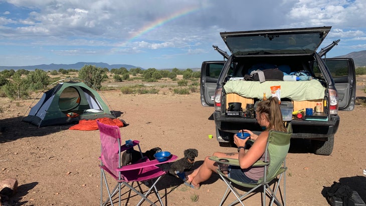
My husband and I were four days into our week-long trip chasing hot springs in the Gila Wilderness in southern New Mexico. Gray wolves had howled us to sleep each night, and one had even stared at us along a long, jeep road. We’d run, hiked, and overlanded the wooded roads and trails within America’s first designated wilderness. We hadn’t seen another person in two days.
But on our mission to find another remote hot spring, we’d gotten turned around. When I pulled out my phone to check the map, nothing would load. We were deep into the Gila’s 558,000 acres of rugged wilderness, with only a quarter tank of gas left in the truck. So we headed north, hoping we’d eventually hit State Road 159, which would bring us back to a main highway. Luckily, we did, but not before plenty of anxiety and bickering put a brief damper on our trip.
Gaia’s new overland map feature would have saved us a lot of guesswork and stress. Designed specifically for vehicle-based adventures, it layers together everything from paved highways to rugged, unmaintained tracks—all with data from OpenStreetMap, the U.S. Forest Service, and BLM. Road surfaces, seasonal closures, public land boundaries, and the next gas station or campsite are all right there. With the map’s color-coding, you can tell at a glance whether you’re headed for smooth gravel or unmaintained dirt, so you can plan accordingly before you’re too far off the grid.
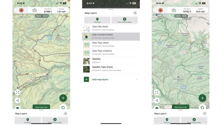
Gaia’s overlanding and planning magic is apparent when you start stacking up different map layers. Want to see where motor vehicles are allowed? Turn on the Motor Vehicle Use Maps layer. Need to make sure you’re camping legally? Add the public and private land overlays. Curious about whether you’ll have service to check in with family—or if there’s a wildfire in the area? Cellular coverage and fire activity layers have you covered. It’s the kind of contextual awareness that turns a nerve-racking drive into a stress-free adventure.
And when it comes time to plan, Gaia’s tools make it easy. The snap-to-trail routing feature automatically follows existing roads, while the freehand “finger” tool on Android lets you sketch your own line through the backcountry. Use the map legends and interactive map on the web to spotlight only what you need—like water sources or campsites. Then, download everything for offline use before you lose signal. Once you’re out there, Apple CarPlay and Android Auto integration mean your map shows up on the dash, not just your phone. In other words: no more arguing about which turn to take when you’re 50 miles from the nearest town.